东北大学学报(自然科学版) ›› 2025, Vol. 46 ›› Issue (4): 124-133.DOI: 10.12068/j.issn.1005-3026.2025.20230292

• 资源与土木工程 • 上一篇    

融合点线特征的视觉-惯性-GNSS紧耦合导航定位方法

贺黎明, 岳峑佑, 曲政林, 张宇   

  1. 东北大学 资源与土木工程学院,辽宁 沈阳 110819
  • 收稿日期:2023-10-16 出版日期:2025-04-15 发布日期:2025-07-01
  • 作者简介:贺黎明(1984—),男,江西萍乡人,东北大学副教授,博士生导师.
  • 基金资助:
    国家自然科学基金资助项目(41974028);中央高校基本科研业务费专项资金资助项目(N2201013)

Visual-Inertial-GNSS Tightly Coupled Navigation and Positioning Method with Fusion of Point and Line Features

Li-ming HE, Quan-you YUE, Zheng-lin QU, Yu ZHANG   

  1. School of Resources & Civil Engineering,Northeastern University,Shenyang 110819,China. Corresponding author: HE Li-ming,E-mail : heliming@mail. neu. edu. cn
  • Received:2023-10-16 Online:2025-04-15 Published:2025-07-01

摘要:

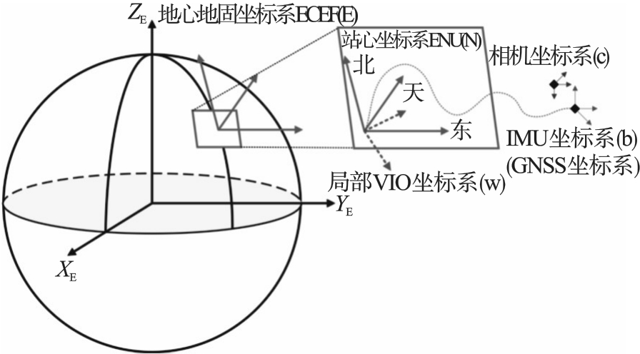
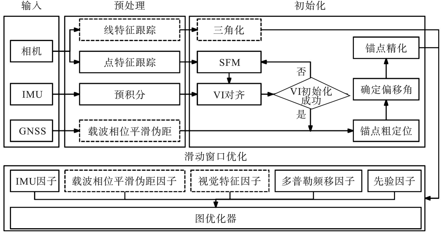
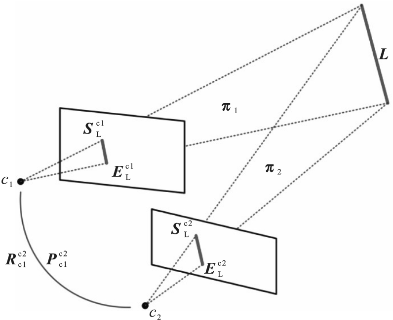
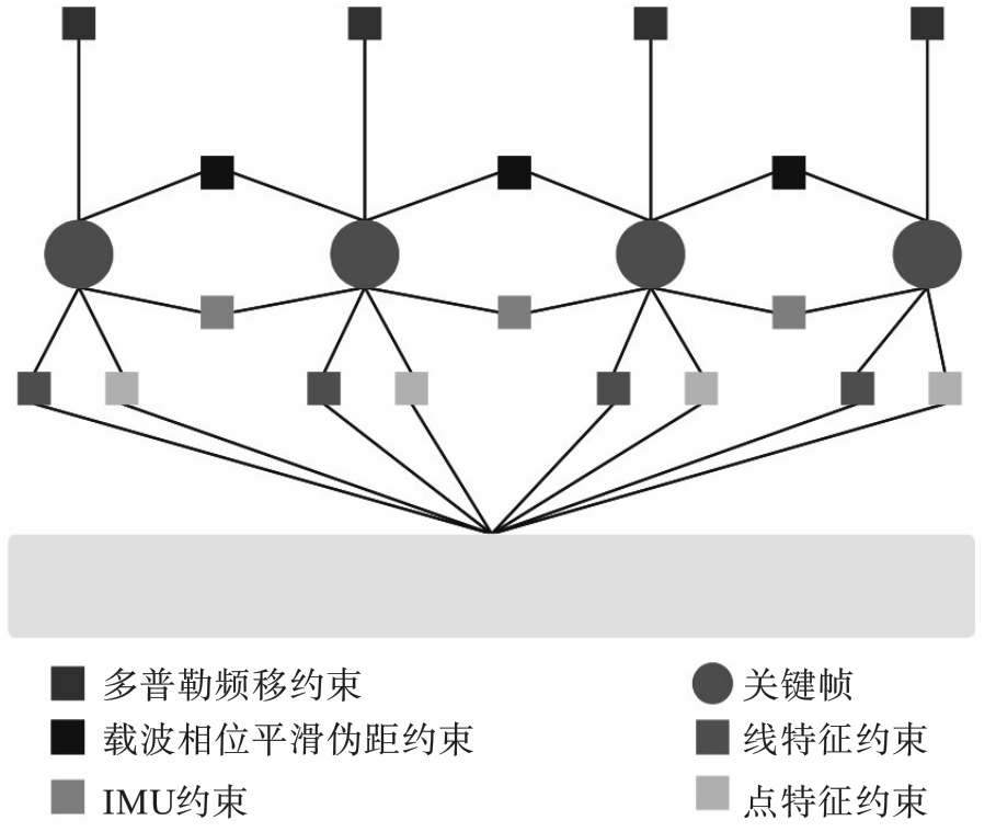
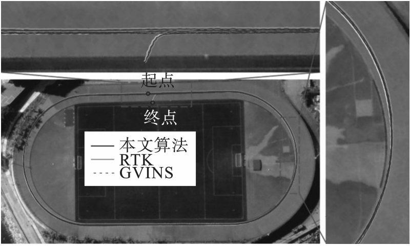
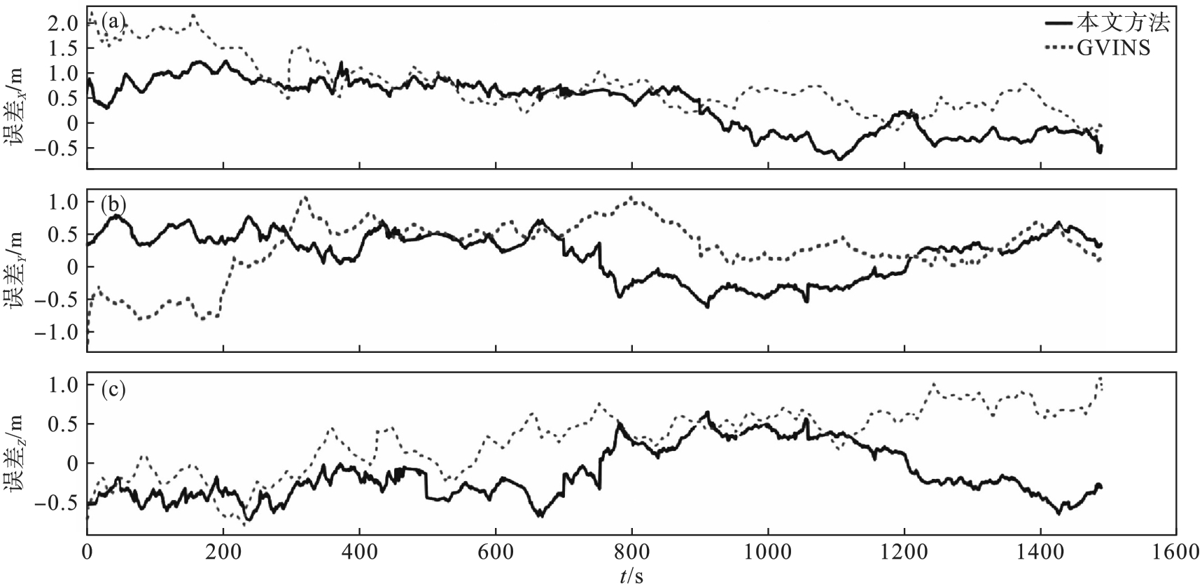
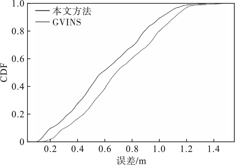
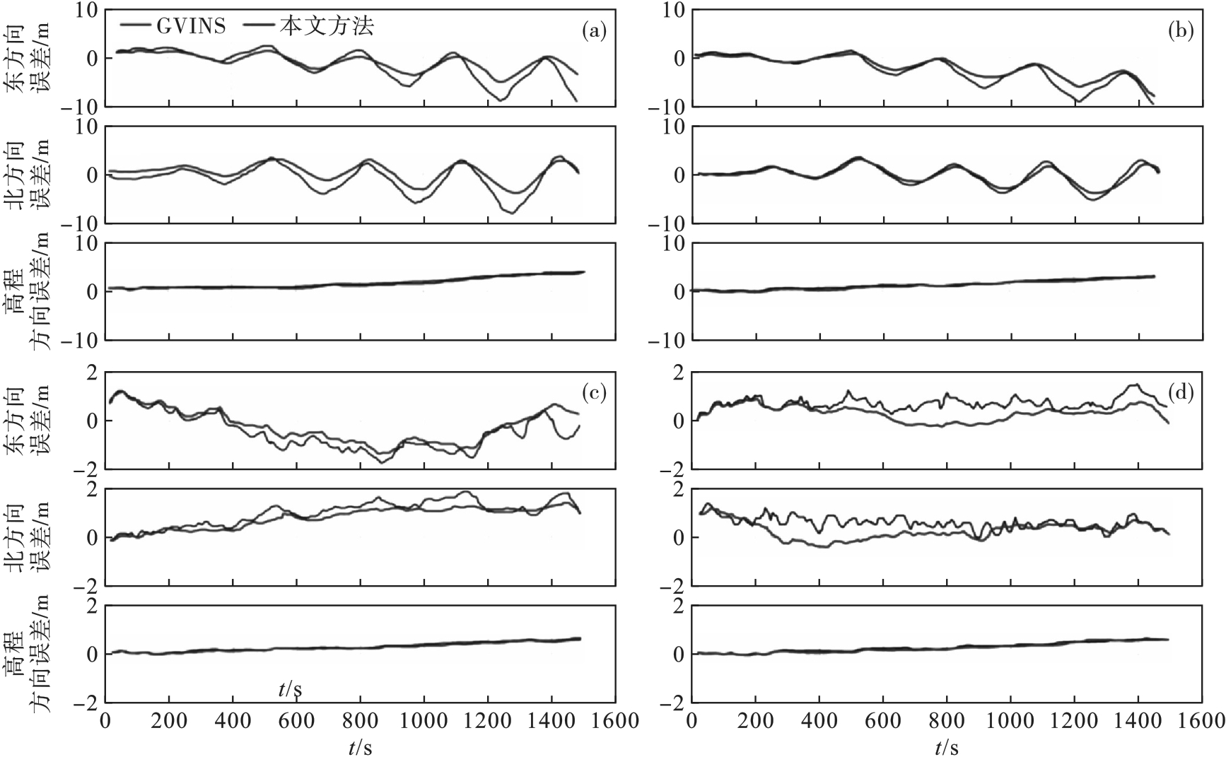
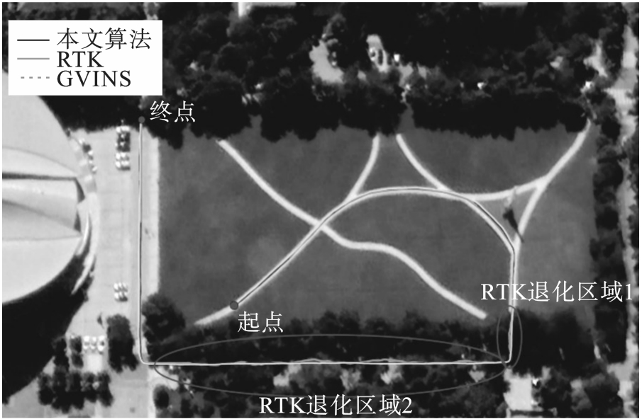
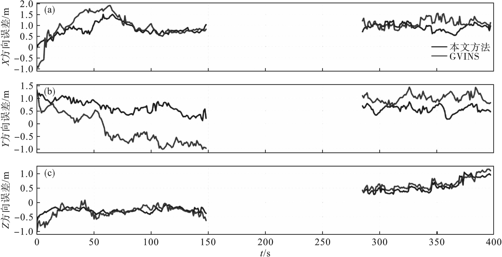
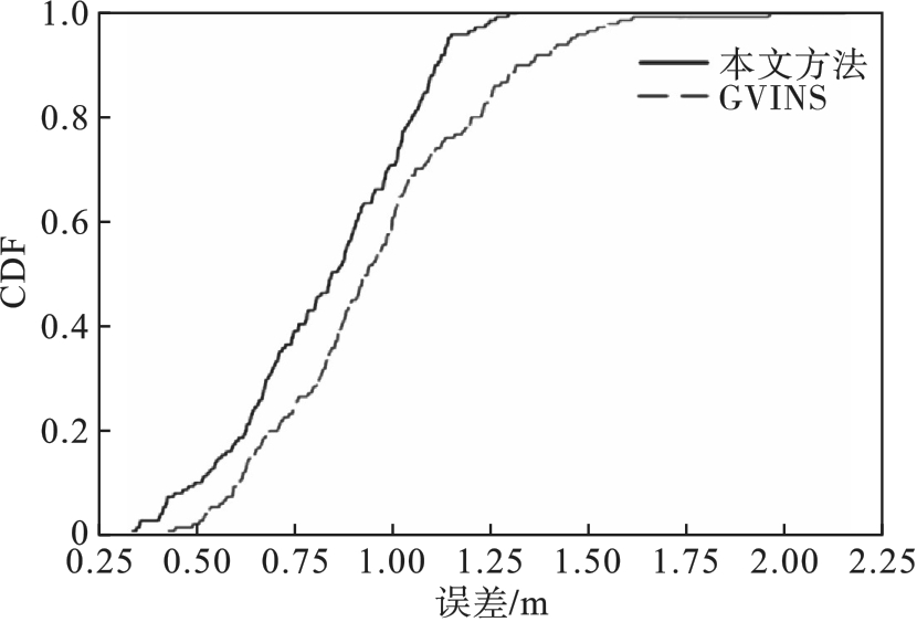
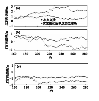
针对复杂环境下单一传感器定位的局限性问题,提出一种多传感器融合的定位方法.在视觉方面,通过在点特征的基础上增加线特征,以克服视觉图像中重复纹理的干扰;在GNSS(global navigation satellite system)方面,通过引入精度更高的载波相位对伪距观测值进行平滑处理,以提高单点定位精度.利用公开数据集和实测数据分别对算法的精度和稳定性进行了验证.结果表明,在公开数据集和实测数据中,所提方法相比于GVINS(视觉-惯性-GNSS紧耦合的算法)在地心地固坐标系下的XYZ 3个方向上,定位精度分别提高了32.2%,23.3%,24.5%和25.7%,25.8%,14.1%.此外,在卫星信号被严重遮挡的环境下,所提方法在一定时间内仍具有良好的定位性能,平面定位精度达到0.74 m,高程定位精度达到0.91 m.研究成果为复杂环境下的多传感器融合定位提供新思路.

关键词: 视觉惯性里程计, 线特征, 载波相位平滑伪距, 图优化, 紧耦合

Abstract:

A multi-sensor fusion positioning method was proposed to address the limitations of single-sensor localization in complex environments. In terms of vision, line features were added to point features to overcome the interference caused by repetitive textures in visual images. In the global navigation satellite system (GNSS), the introduction of carrier phase with higher accuracy was used to smooth the pseudorange observations, which improved the accuracy of single point positioning. The accuracy and stability of the algorithm were validated by using both public datasets and measured data. In both public datasets and actual data, the accuracy of the proposed method is improved by 32.2%, 23.3%, 24.5%, and 25.7%, 25.8%, and 14.1% in the XY, and Z directions, respectively, compared to the GVINS (visual inertial GNSS tightly coupled algorithm) in the geocentric coordinate system. In addition, in the environments where satellite signals are severely obstructed, the proposed method still has good positioning performance for a certain period of time, with a positioning accuracy of 0.74 m in plane and 0.91m in elevation. Research results provide new insights for multi-sensor fusion position in complex environments.

Key words: visual-inertial odometry, line feature, carrier phase smoothed pseudorange, graph optimization, tightly coupled

中图分类号: